
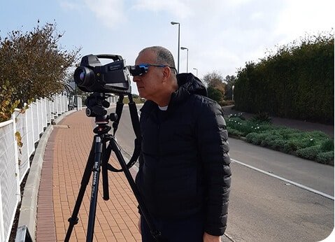
Thermal cameras, optical gas imaging systems and laser sensors are sometimes grouped together as if they produce the same answer. They do not. Each detects a different physical signal, and each has operating conditions that affect what the operator can conclude.
What each sensor can and cannot see
The underlying issue is large sites, elevated equipment, buried biogas infrastructure, and leaks that are difficult to locate with component-by-component checks alone. It should be defined in measurable terms before a team selects equipment or requests bids. A clear problem statement also prevents a survey from expanding into unrelated work. The scope should distinguish symptoms from causes and identify the consequence of doing nothing. That gives decision-makers a basis for ranking the work against other maintenance needs.
Thermal imaging versus optical gas imaging
The technical options include optical gas imaging, infrared thermography, thermal cameras, laser-based gas sensors, drones, and georeferenced survey data. Selection depends on what must be detected, located, measured or verified. A method that is excellent for screening may still need a more precise follow-up tool. Field teams should record environmental conditions and known sources of interference. Those notes allow reviewers to judge whether an apparent anomaly is credible and whether a return visit is necessary.
How drone-mounted laser sensors work
The role of detecting gas leaks becomes clearer when the survey result is tied to a field action and a verification step. Practitioners may use optical gas imaging, infrared thermography, thermal cameras, laser-based gas sensors, drones, and georeferenced survey data. No instrument should be treated as a black box. The operator needs to understand the measurement principle, common interference and the threshold for confirmation. Equipment capability matters, but operator competence often determines data quality. Training and documented procedures make results more consistent across crews, sites and reporting periods.
Why aerial coverage changes survey planning
Expected value includes rapid coverage, access to hard-to-reach areas, visual evidence, and better prioritization of maintenance resources. These benefits should appear in operating measures, not only in a proposal. Useful indicators include confirmed findings, response time, recurrence, service interruption and total cost to close an issue. Indirect gains also matter, including fewer site visits, less reinstatement, clearer customer communication and stronger capital planning. They should be counted only when the organization can show how they were achieved.
Ground confirmation remains essential
Relevant limits include not every thermal anomaly is gas, weather affects detection, and qualified interpretation and ground confirmation remain essential. A defensible report states those limits beside the result instead of hiding them in general notes. Readers can then decide how much confidence is sufficient for the next action. Contract documents should also define who owns the data and how it will be delivered. Proprietary outputs have limited long-term value when the asset owner cannot reuse them in mapping or maintenance systems.
Data needed for repeatable inspections
The working sequence is straightforward: design a safe flight or mobile route, collect imagery and concentration evidence, account for environmental conditions, locate likely sources, verify them on the ground, and document repairs. Each stage should have an owner and an acceptance check. This makes delays visible and shows whether the result changed maintenance, billing, safety or environmental performance. Completion records should show what changed after intervention. A second measurement, inspection or operational check is often the clearest proof that the original issue was addressed.
Selecting the right sensor combination
The main constraints are not every thermal anomaly is gas, weather affects detection, and qualified interpretation and ground confirmation remain essential. They belong in the technical scope because they can change accuracy, safety and usability. Critical findings may require confirmation by another method or physical exposure. The report should state confidence and explain what could not be determined. Honest limits help engineers choose safe follow-up work and prevent a preliminary finding from being used for a decision it cannot support.
What should teams confirm before a drone gas survey?
They should confirm the asset type, operating condition, required accuracy and the decision the result must support. For this topic, the main constraints are not every thermal anomaly is gas, weather affects detection, and qualified interpretation and ground confirmation remain essential. A short pre-field review should document those limits, identify any need for a second method and set the acceptance check for the final result.
How can owners verify the value of a drone gas survey?
Verification starts with a baseline and a measure tied to the intended outcome. Expected gains include rapid coverage, access to hard-to-reach areas, visual evidence, and better prioritization of maintenance resources. Owners should compare conditions before and after the intervention, confirm that priority findings were closed and record any recurrence. That produces a direct answer instead of relying on a vendor claim or an untested estimate.
Conclusion
Sensor choice should follow the question, the site and the required confidence. For oil and gas operators, landfill managers, regulators, engineers, and maintenance teams, the next step is to define the decision, choose evidence that can support it and assign responsibility for follow-up. That approach keeps the work factual, measurable and useful after the initial survey or installation.


